|
Five Largest Cities:
1. Copenhagen 2. Aarhus 3. Odense 4. Aalborg 5. Frederiksberg |
Population of Copenhagen: 1,153,615
|
Prediction of population:
Aarhus: 576,808 Odense: 384,538 Aalborg: 288,404 Frederiksberg: 230,723 |
Actual population:
Aarhus: 237,551 Odense: 145,631 Aalborg: 112,219 Frederiksberg: 95,029 |
The rank size model does not accurately predict the population of Denmark's largest cities.
Copenhagen is Denmark's primate city.
Copenhagen is Denmark's primate city.
|
Urban Population:
87.7% of total population |
Rate of Urbanization:
0.6% |
100% of Denmark's urban population has access to improved drinking water. 99.6% of Denmark's urban population has access to improved sanitation facilities.
The model that seems to fit the structure of cities in Denmark is the Multiple Nuclei model. This is so because the cities of the fact that are are multiple nodes in these cities. For example, Copenhagen has many different attractions (museums, gardens, historical markers), different transportation stations, a power plant, and other different forms of services.
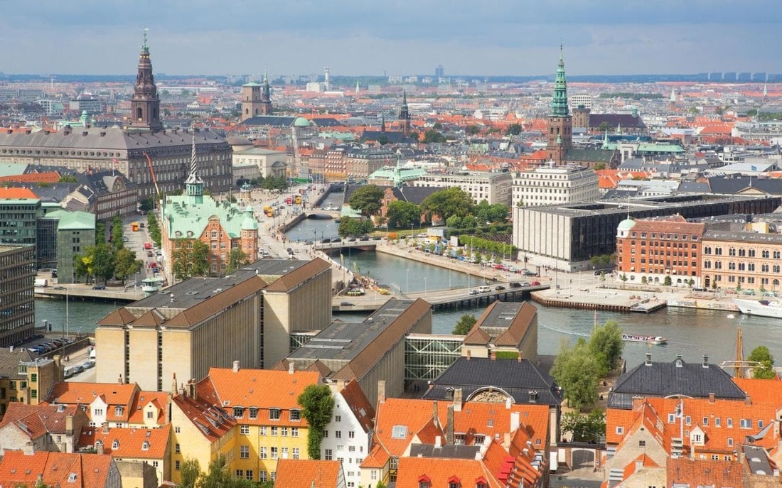
Copenhagen
|

Aarhus
|
Odense
|

Urban Areas
|
The site of Copenhagen is located in the Capital Region of Denmark and on the country's east coast on the Øresund Strait. Its longitude and latitude is 55.6761° N, 12.5683° E.
Situationally speaking, Copenhagen is on the other side of the Øresund Strait from Sweden and very close to the Swedish city of Malmö. |
Functional Zonation
There are different ways in which Copenhagen is broken up into different regions/zones. 1. Bus Fares. This is an example of functional zonation because of the fact that the city is divided into 95 different zones to determine how much you will need to pay to take the bus. 2. City Districts. Because Copenhagen is broken down into around eight districts, it is an example of functional zonation. The breaking down into districts allows the Copenhagen government to more easily deal with all of the people in the city. 3. Neighborhoods. Copenhagen can also be divided into the places where people live. |
